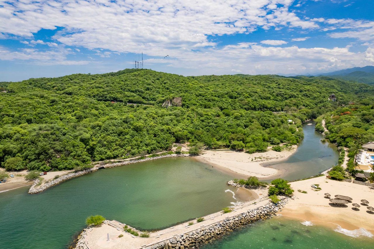
Aerial view of a forested coastal inlet, with a sandy beach and stone seawall.
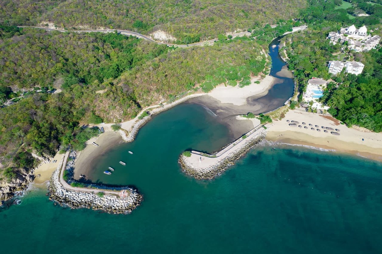
Aerial coastline with a winding inlet, sandy beaches, breakwaters, and wooded land.
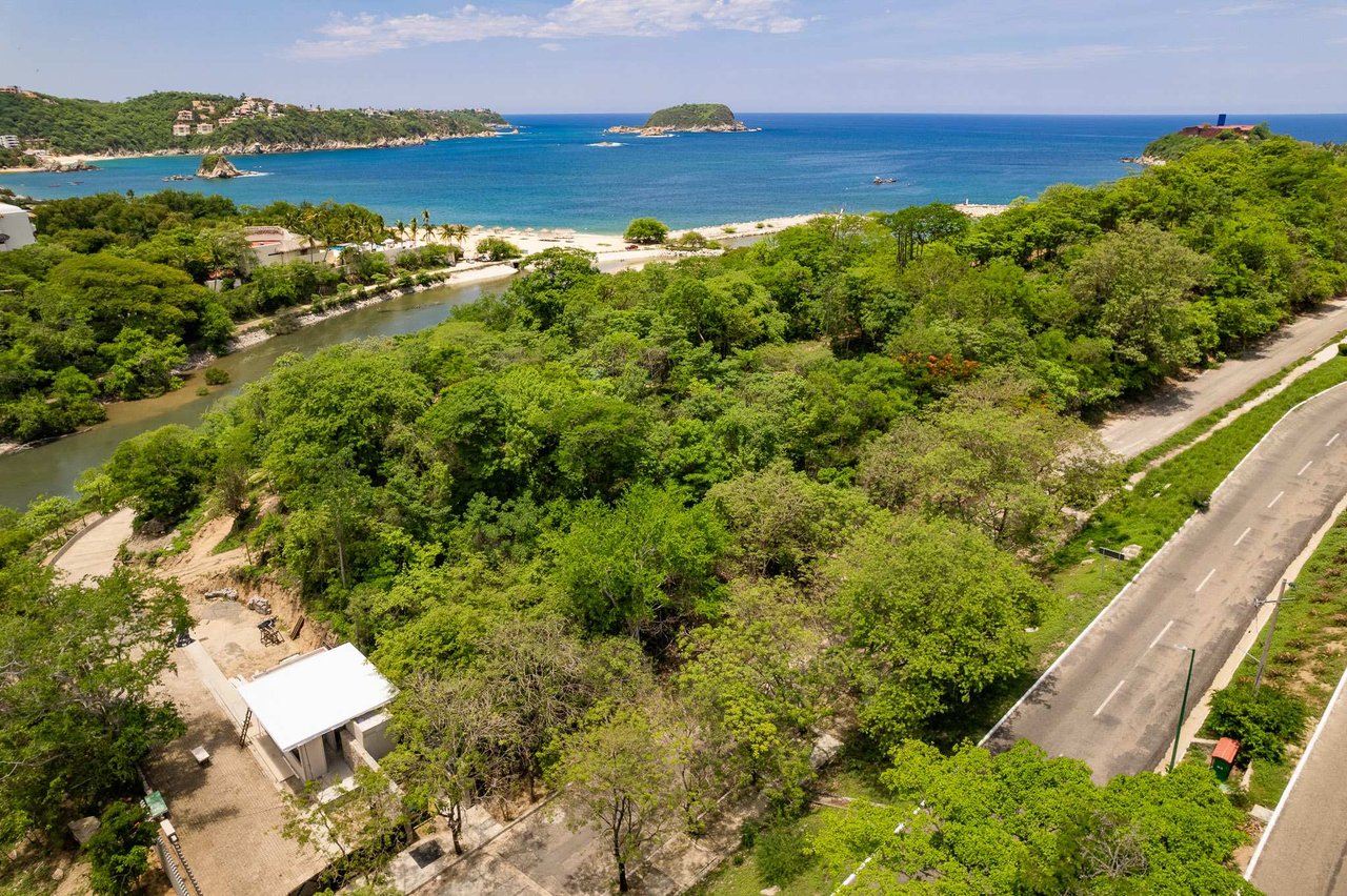
Coastal land parcel bordered by a road, with a beach and bay beyond.
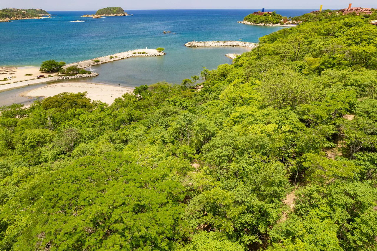
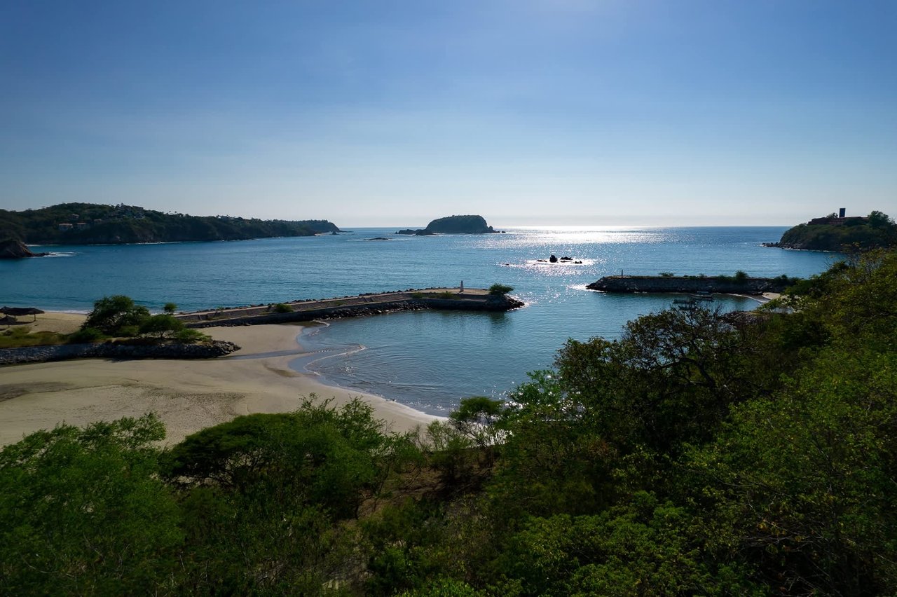
Aerial view of wooded land overlooking a sheltered bay, sandy shoreline, and open ocean.
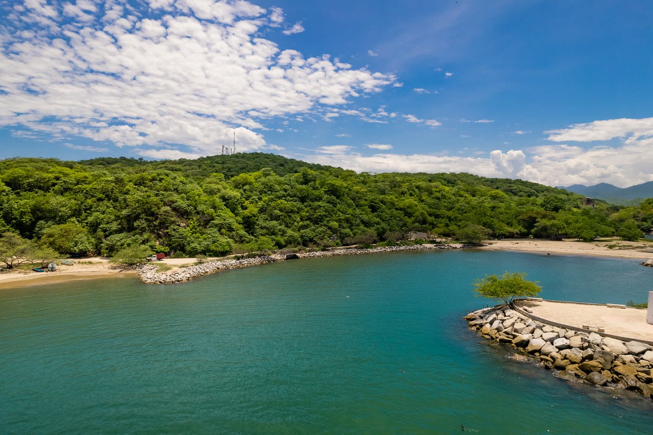
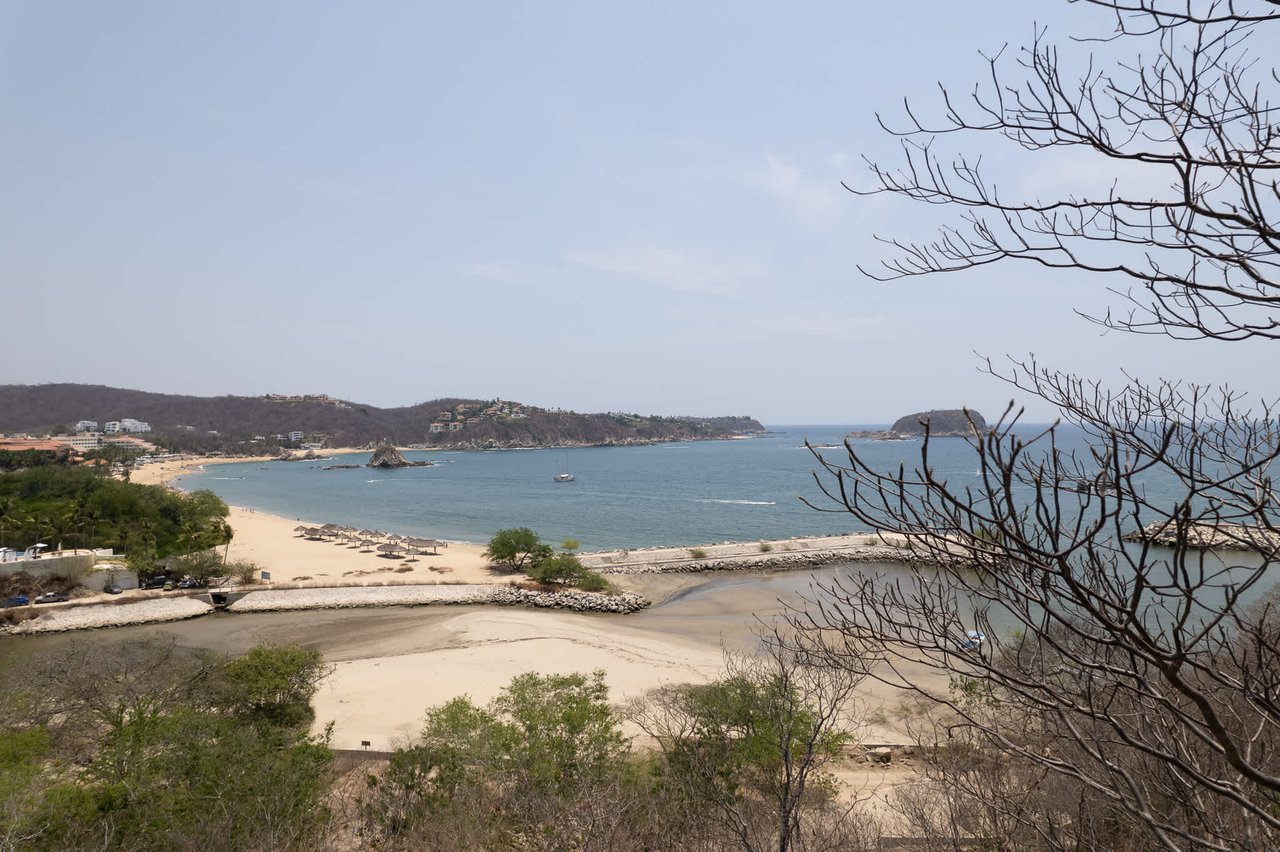
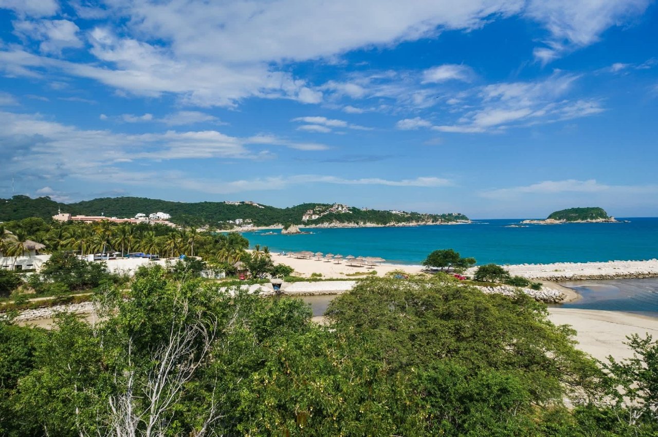
Coastal bay at Los Altos with turquoise water, a sandy beach, and wooded hills.
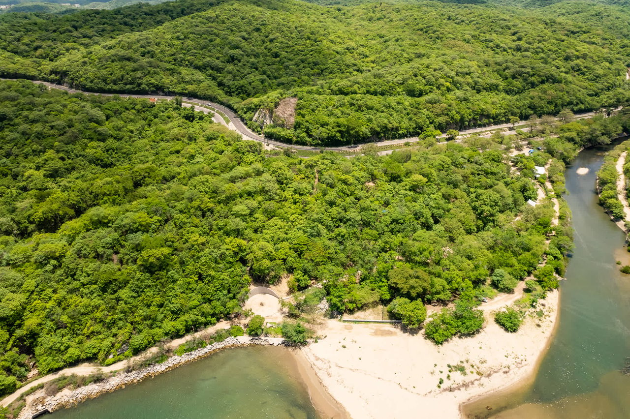
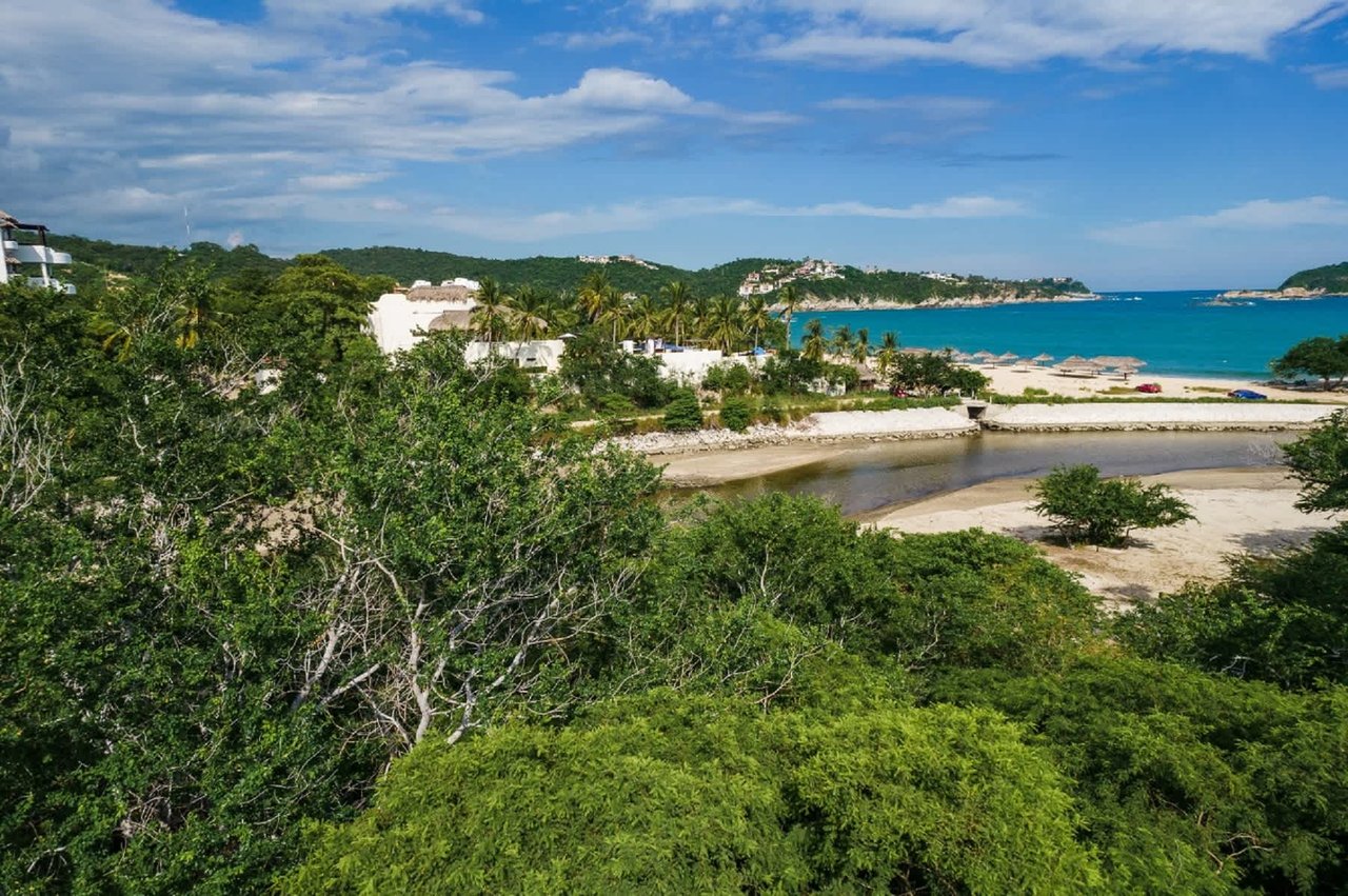
Wooded land beside a river and sandy shoreline, with a winding road through the hills.
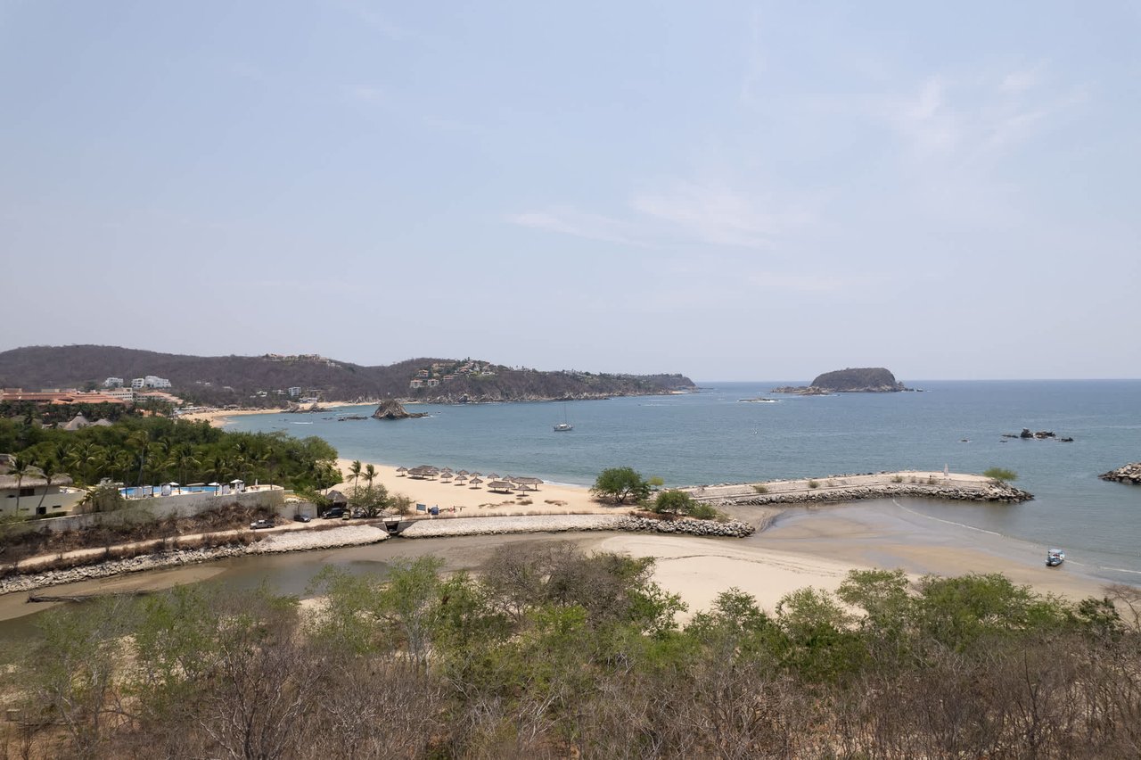
Coastal bay view with a sandy beach, anchored sailboat, and rocky headlands.
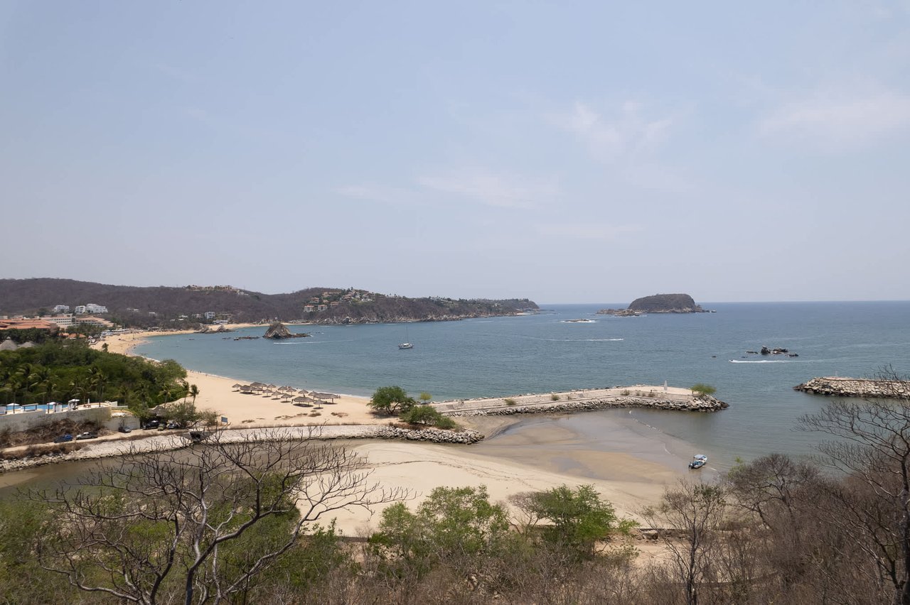
Coastal bay with sandy beaches, rocky headlands, and a small offshore island.
Coastal bay and sandy beach viewed from above, with boats and hillside buildings in the distance.
Coastal view of a sandy beach and turquoise bay beyond green vegetation and a lagoon.
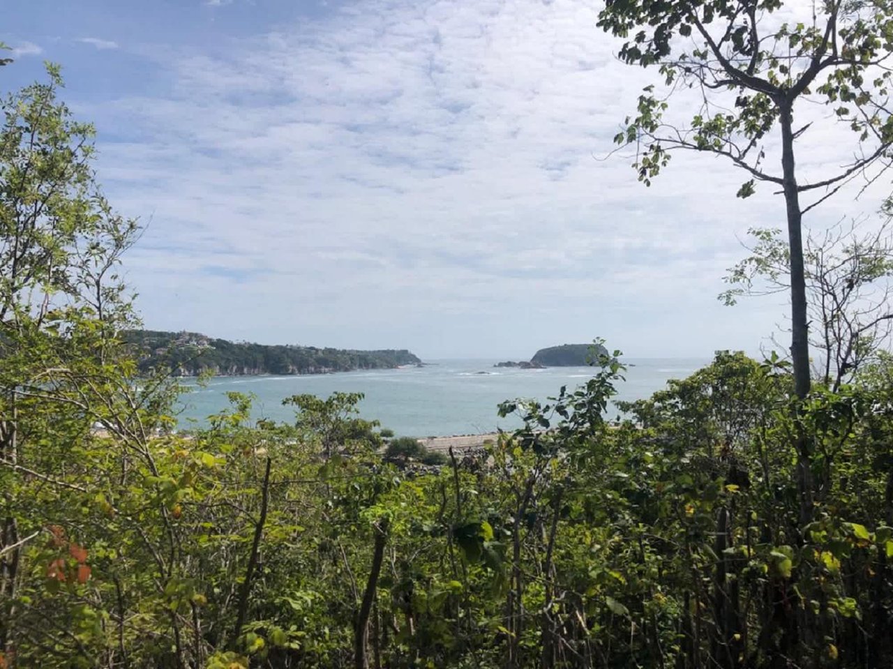
Hillside land overlooking a coastal bay, framed by trees and dense foreground vegetation.
Sheltered bay with sandy shoreline, green hills, and a rocky island offshore.
Turquoise bay and sandy beach framed by palms and green coastal hills.
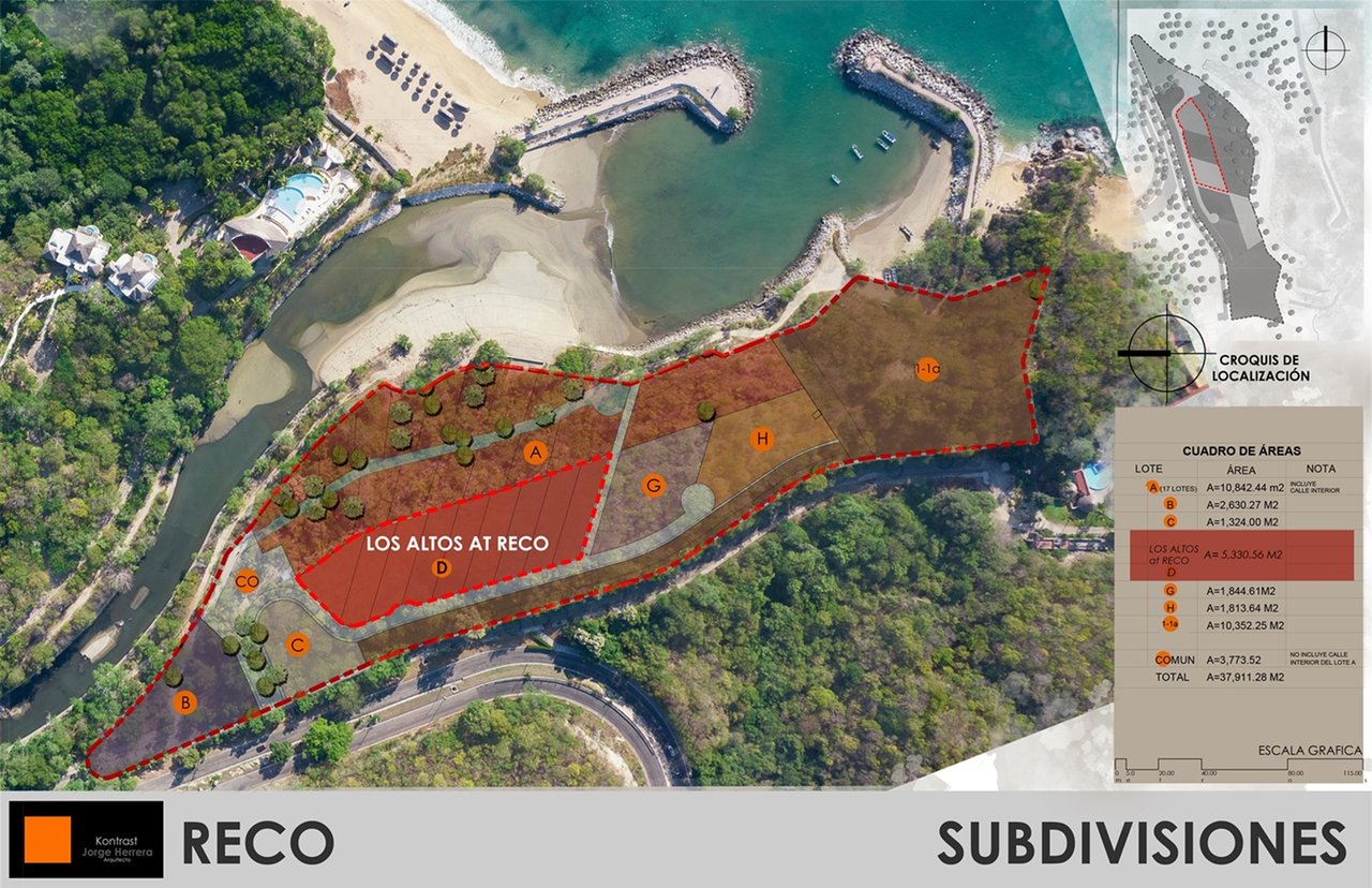
Aerial subdivision plan marking Los Altos at Reco lots beside a coastal inlet.
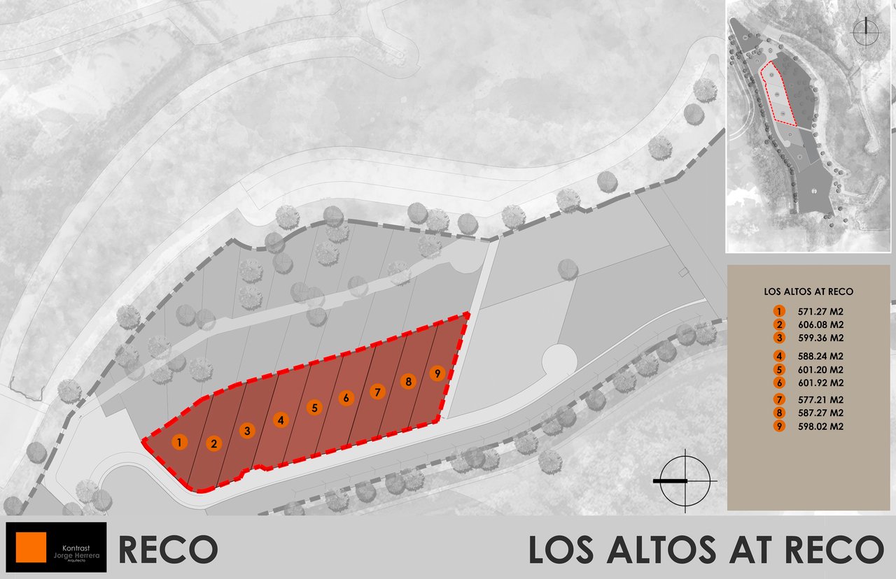
Site plan highlighting nine numbered Los Altos lots, with each lot’s area listed in a legend.
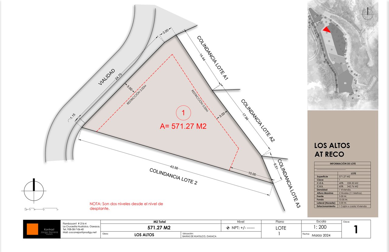
Los Altos Lot 1 site plan showing its 571.27-square-meter area, boundaries, setbacks, and location inset.
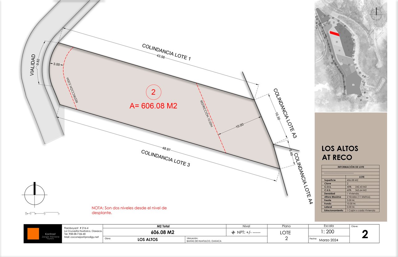
Site plan for Los Altos lot 2, showing its 606.08-square-meter parcel, dimensions, neighboring lots, and access road.
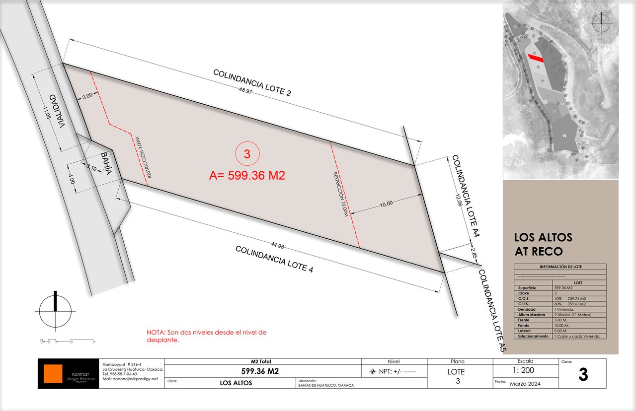
Los Altos lot 3 site plan showing the 599.36-square-meter parcel, boundary dimensions, and neighboring lots.
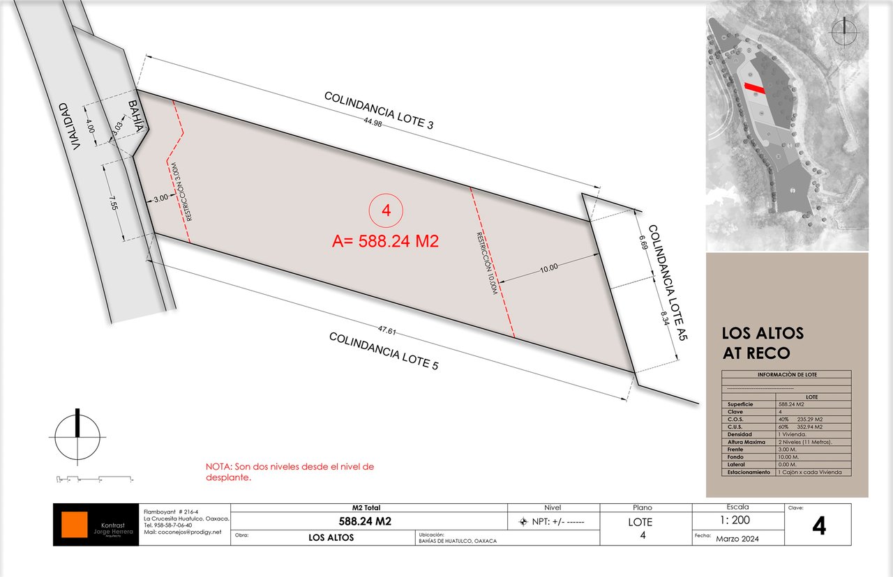
Los Altos lot 4 site plan showing a 588.24-square-meter parcel, boundaries, dimensions, and neighboring lots.
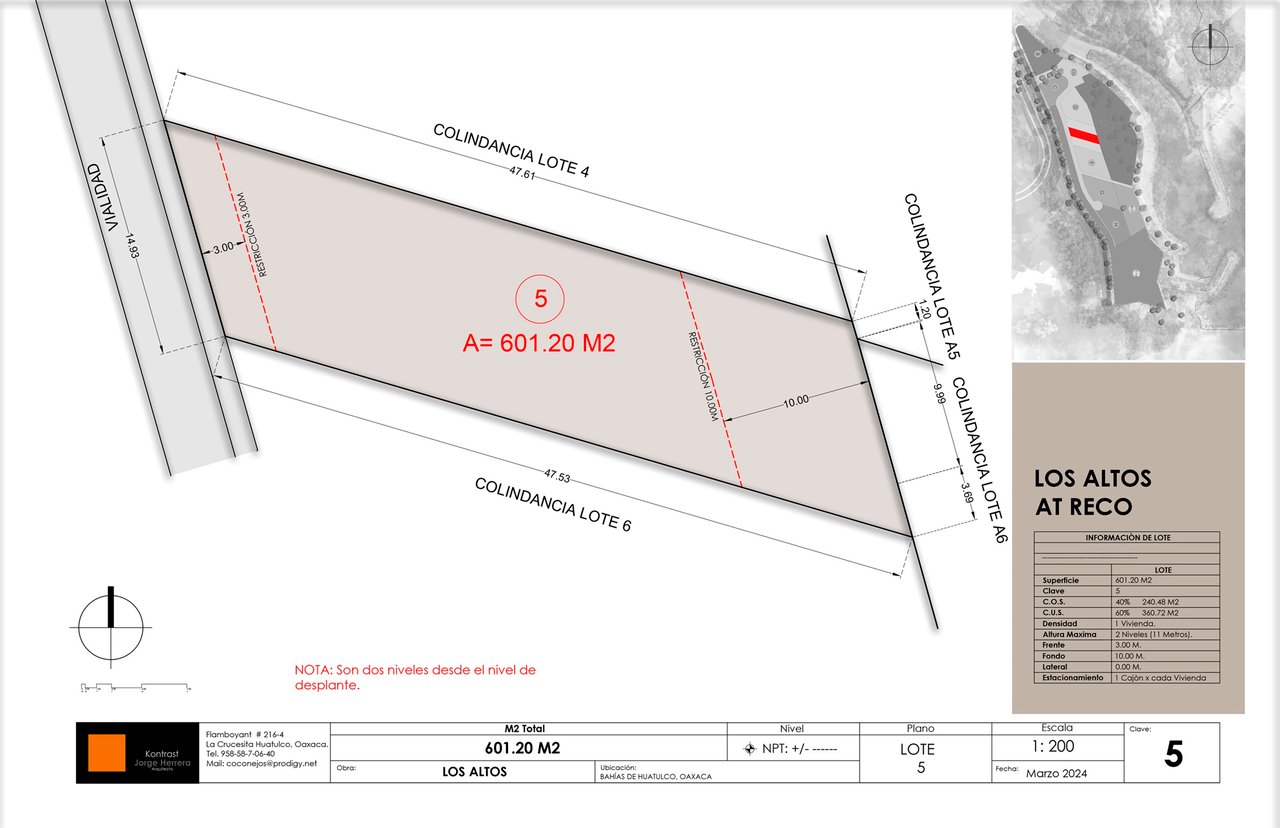
Los Altos lot 5 site plan showing a 601.20-square-meter parcel and its boundaries.
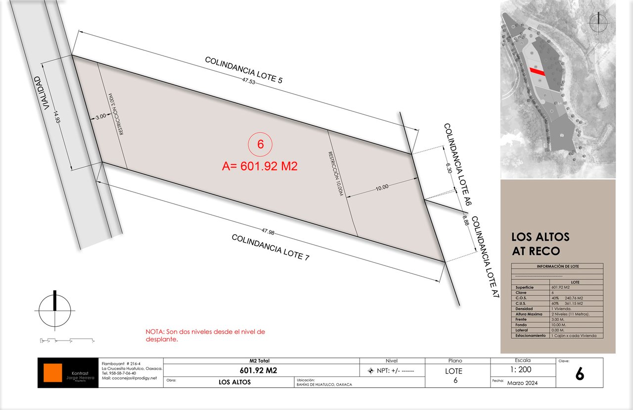
Survey plan for Los Altos lot 6, showing its 601.92-square-meter area, boundaries, and dimensions.
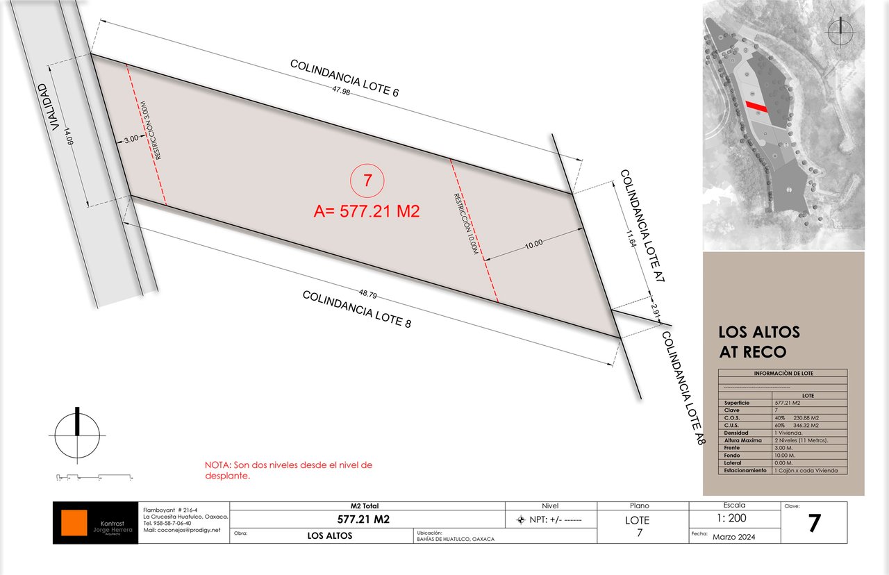
Los Altos lot 7 site plan, a 577.21 m² parcel with boundaries, dimensions, setbacks, and location inset.
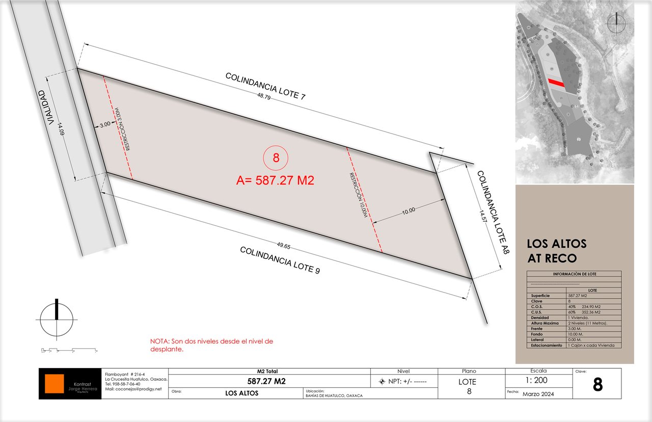
Site plan of Los Altos lot 8, a 587.27-square-meter parcel with dimensions and neighboring lots.
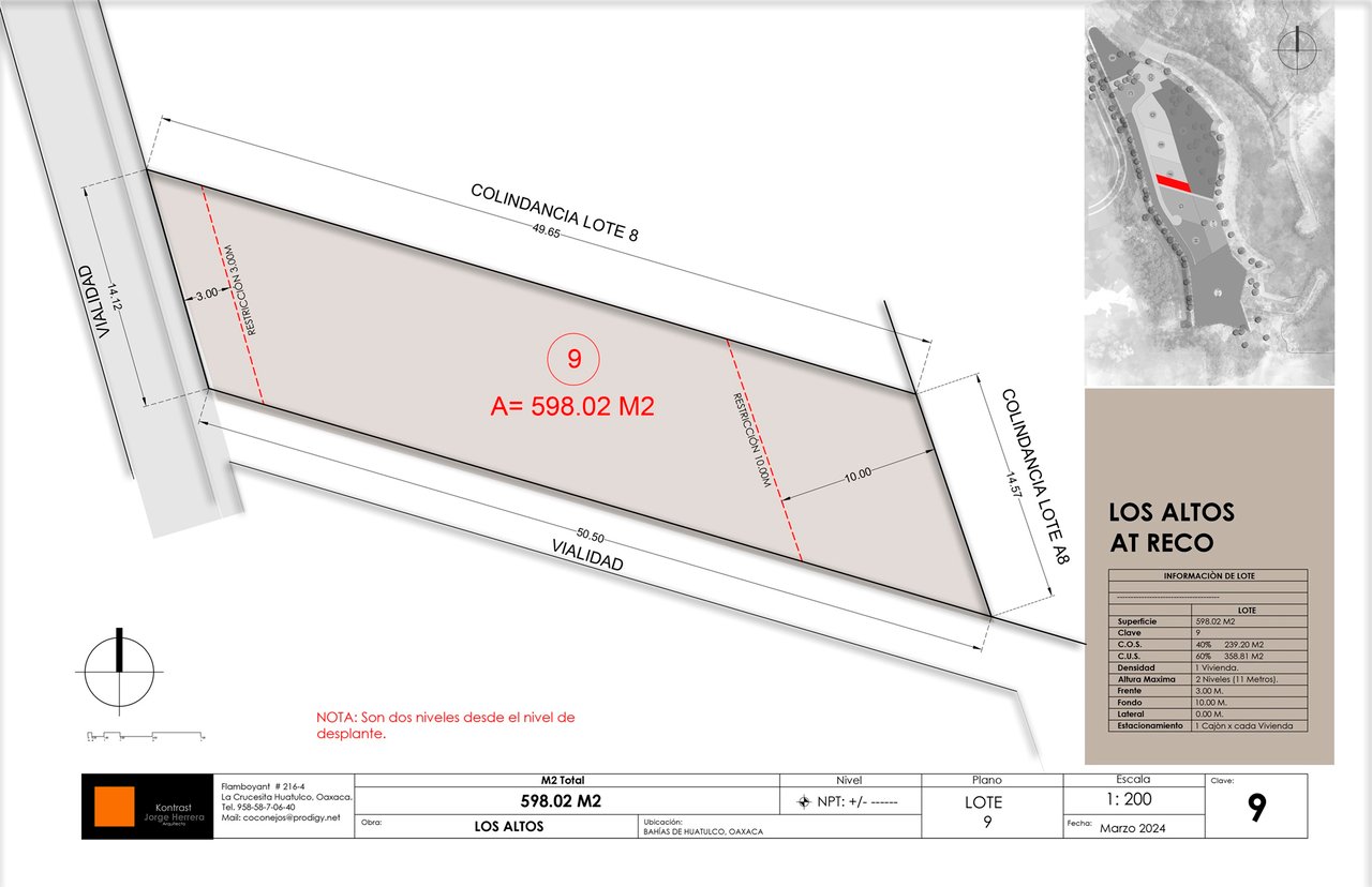
Site plan for Los Altos lot 9, showing a 598.02-square-meter parcel and its boundaries.
SEE ALL PHOTOS
Aerial view of a forested coastal inlet, with a sandy beach and stone seawall.
Aerial coastline with a winding inlet, sandy beaches, breakwaters, and wooded land.
Coastal land parcel bordered by a road, with a beach and bay beyond.
Aerial view of wooded land overlooking a sheltered bay, sandy shoreline, and open ocean.
Coastal bay at Los Altos with turquoise water, a sandy beach, and wooded hills.
Wooded land beside a river and sandy shoreline, with a winding road through the hills.
Coastal bay view with a sandy beach, anchored sailboat, and rocky headlands.
Coastal bay with sandy beaches, rocky headlands, and a small offshore island.
Coastal bay and sandy beach viewed from above, with boats and hillside buildings in the distance.
Coastal view of a sandy beach and turquoise bay beyond green vegetation and a lagoon.
Hillside land overlooking a coastal bay, framed by trees and dense foreground vegetation.
Sheltered bay with sandy shoreline, green hills, and a rocky island offshore.
Turquoise bay and sandy beach framed by palms and green coastal hills.
Aerial subdivision plan marking Los Altos at Reco lots beside a coastal inlet.
Site plan highlighting nine numbered Los Altos lots, with each lot’s area listed in a legend.
Los Altos Lot 1 site plan showing its 571.27-square-meter area, boundaries, setbacks, and location inset.
Site plan for Los Altos lot 2, showing its 606.08-square-meter parcel, dimensions, neighboring lots, and access road.
Los Altos lot 3 site plan showing the 599.36-square-meter parcel, boundary dimensions, and neighboring lots.
Los Altos lot 4 site plan showing a 588.24-square-meter parcel, boundaries, dimensions, and neighboring lots.
Los Altos lot 5 site plan showing a 601.20-square-meter parcel and its boundaries.
Survey plan for Los Altos lot 6, showing its 601.92-square-meter area, boundaries, and dimensions.
Los Altos lot 7 site plan, a 577.21 m² parcel with boundaries, dimensions, setbacks, and location inset.
Site plan of Los Altos lot 8, a 587.27-square-meter parcel with dimensions and neighboring lots.
Site plan for Los Altos lot 9, showing a 598.02-square-meter parcel and its boundaries.
OCEAN VIEW

Land, Los Altos

Tangolunda, Bahias de Huatulco, Oaxaca 70989, Mexico

$265,000

9 stunning residential lots with East facing views are located within this private gated community in Tangolunda. These large residential properties have direct access to FOUR beaches and are zoned to allow single family homes.

Build your home, vacation rental & family getaway all on the same piece of property. With architectural controls in place, enjoy cohesive design throughout.  Limited availability!

  • Ocean View
  • Security
  • Beach Access
  • Gated Community
  • Secure Investment

6,147 Sq.Ft. lot

Property Virtual Tour

Features & Amenities

Area & Lot

  • Status OCEAN VIEW
  • Total Area571 Sq.M.
  • Lot Area6,147 Sq.Ft.
  • TypeLand
  • NeighborhoodHuatulco

Exterior

  • utilitiesOcean View, Security, Beach Access, Gated Community, Secure Investment

Financial

  • Sales Price$265,000

Schedule a Showing

We would love to show you our beautiful property. Please select your preferred date and time below. An agent will be in touch shortly to confirm your appointment.

Schedule a Showing

We would love to show you our beautiful property. Please select your preferred date and time below. An agent will be in touch shortly to confirm your appointment.

Schedule a Showing

We would love to show you our beautiful property. Please select your preferred date and time below. An agent will be in touch shortly to confirm your appointment.

Huatulco

Discover the serenity and vibrancy of coastal living

Explore

Your Real Estate Journey Made Easy

Experienced and knowledgeable agents making buying & selling Real Estate easy on the coast of Oaxaca, Mexico.

Follow Us on Instagram

WhatsApp